
Transport
from and to the quarry
In
the earliest days of quarrying at Rhosydd the route used to transport the
slate to market was via a well constructed packhorse track from the West Twll around
the east shoulder of Moelwyn Mawr and over the high pass between Moelwyn
Mawr and Moelwyn Bach. This path was only suitable for pack animals
and it led eventually to the Afon Dwyryd near Maentwrog. The path
may be clearly followed today in its upper reaches and it can be seen from
the Stwlan Dam above Tan y Grisiau. Stwlan Dam used to be accessed
by a private road open to the public, however this concession has now been
withdrawn. (continued)
Packhorse
track from the quarry
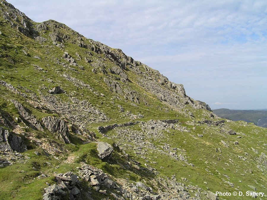
Two views of the old packhorse track on the slopes of Moelwyn Mawr. Looking back towards the quarry above and looking towards Moelwyn Bach below.
As production increased in the 1850's and moved down the mountainside to the north it became impractical to continue to use this track and a better outlet was sought. The nearest railway at that time was the Ffestiniog at Tan y Grisiau and the present access to the quarry via Cwmorthin was improved by the Rhosydd company. Despite the ferocious gradients on parts of this route it became practical to use carts to transport the slate with a consequent increase in productivity. This route however was not without its problems as the owners of Cwmorthin Quarry near the bottom of the valley made life as difficult as possible for their rivals. A series of long and acrimonious disputes followed and it became clear that the only course for Rhosydd to take was to have its own independent tramway access. (continued)
Looking down Cwmorthin towards Tan y Grisiau
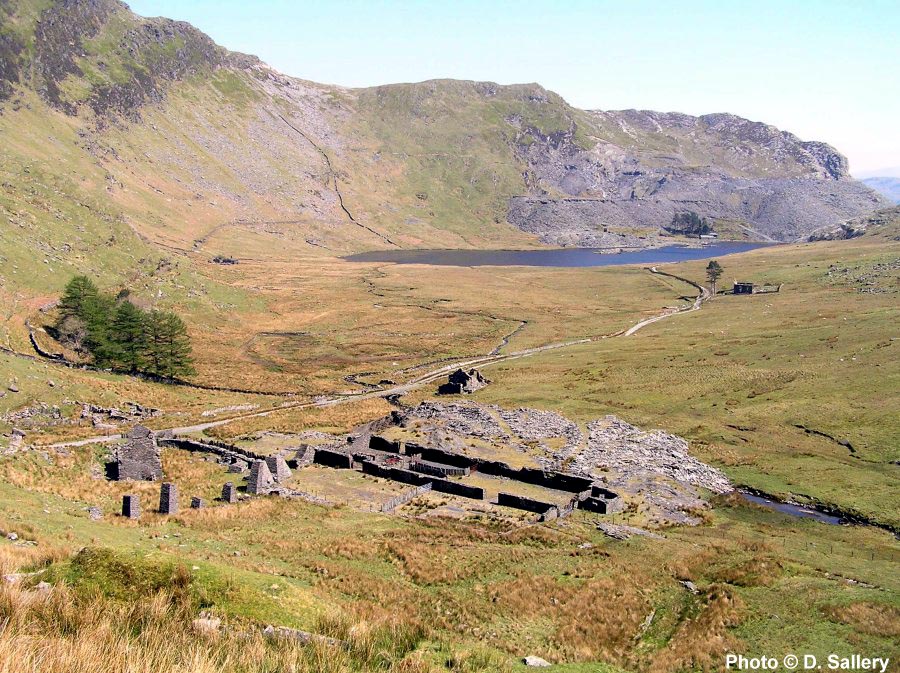
Looking
down Cwmorthin from the Rhosydd access path. In the distance can
be seen Llyn Cwmorthin and Cwmorthin quarry. The trees on the left
mark the site of Plas Cwmorthin - the Rhosydd manager's house. The
remains of the dressing shed in the centre is that of Conglog quarry
and the pillars of the launder which carried water to its wheel can be
seen. Just above the dressing shed are the ruins of the Rhosydd stables
while the roofless cottages to the left of the launder were also Rhosydd
property. The building in the middle distance, with the solitary
tree, is Rhosydd Chapel. Conglog quarry was linked to the Ffestiniog
railway by tramway from 1876. This tramway was never used to transport
Rhosydd slate.
The long term
solution for Rhosydds endemic transport problems came about through connection
to the two foot gauge Croesor Tramway. This lay roughly in the opposite
direction to Cwmorthin and it led directly to Porthmadog and the sea via
Croesor village and the flat reclaimed lands of the Glaslyn estuary.
The tramway was built to serve Croesor quarry which was a mile to the west
of Rhosydd and the addition of a branch to serve Rhosydd was a logical
development. The tramway was opened to Rhosydd in 1864 and the quarry's
transport costs dropped to less than half of what they had been.
The Croesor Tramway was entirely horse powered in its upper reaches and
the track and permanent way was of very light construction. There
was no operating company in the accepted sense and the quarries supplied
their own horses and wagons and then paid a fee, based on tonnage,
to use the tramway. Ironically, this is similar to the position
of Network Rail in today's national railway network. There were a
total of four inclines on the tramway from Rhosydd to the sea and the distance
to the wharves at Porthmadog was just over eight miles. From 1868
Rhosydd also gained access to the main line railway through the opening
of a transshipment siding at Porthmadog with the Cambrian Railway.
From this date it is likely that the use of sea transport declined significantly.
Part of the route of the Croesor Tramway, in the Glaslyn valley,
was taken over and rebuilt for locomotive haulage in 1923 becoming The
Welsh Highland Railway. This section of line has now been reopened
throughout from Caernarfon to Porthmadog.
To
reach the level stretch of the Croesor valley from Rhosydd entailed a vertical
drop of over 800 feet in less than two miles and truly Herculean engineering
works were required. From the quarry the tramway route heads west
over relatively level ground, passing the quarry explosives store on the
way. There are various cuttings and embankments as it pursues a course
to the head of Cwm Croesor. The enormity of the task facing the builders
is now clear as the valley floor comes into view several hundred feet below.
The tramway is built on a narrow shelf cut out of the mountainside to the
head of the main incline. (continued)
The tramway at the head of Cwm Croesor
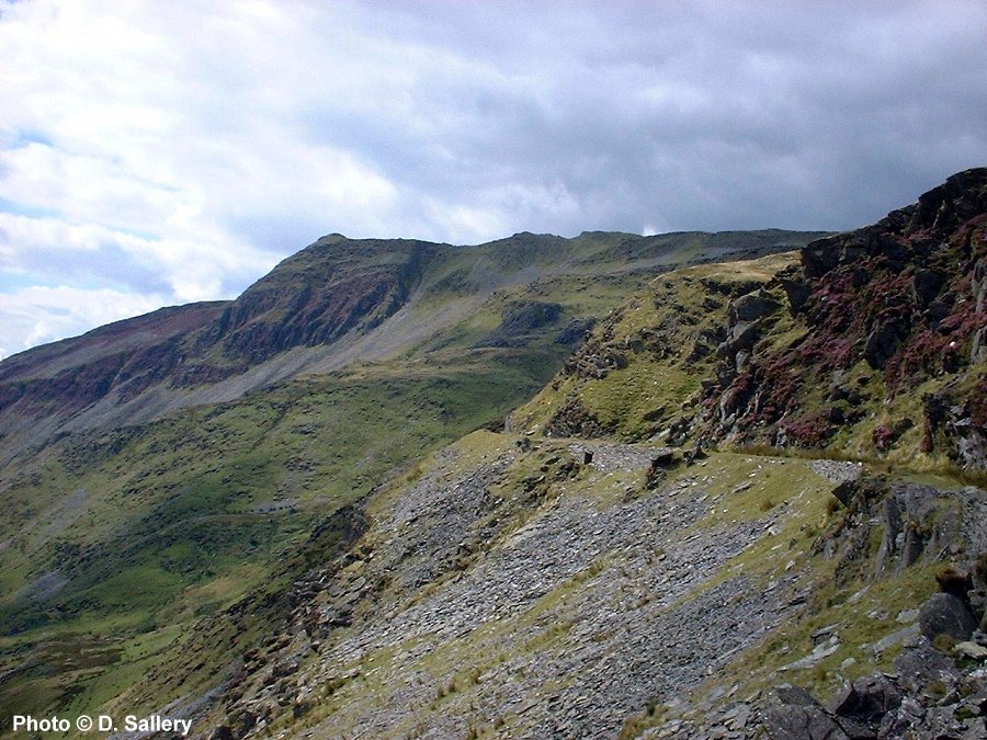
The
route of the tramway follows a course along
the mountainside to the head of the main incline.
The mountain in the background is Cnicht - 2,265 feet high. It is
known as the Welsh Matterhorn because of its appearance from Porthmadog
and the Glaslyn valley. In reality it is merely the culmination of
a long ridge and not a true peak. There are more views of the tramway
route on
the Photo Gallery Pages
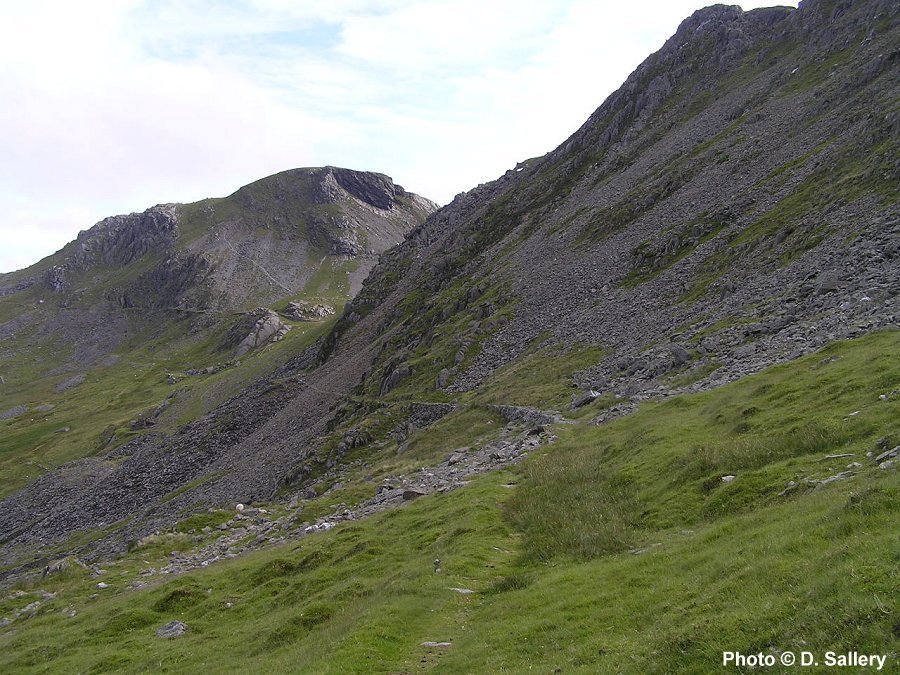
The
main incline from Rhosydd quarry is arguably the most impressive in the
whole slate industry. It is a balanced gravity incline with the weight
of the downwards load pulling up the inwards one. The incline drum
had two wire reinforced ropes wound around it, one of which was for downwards
traffic and one for upwards. The vertical drop of the incline is 670 feet
and the horizontal distance is 1250 feet. This gives an average gradient
of 1 in 1.86. However because the mountainside is practically vertical
at the top, the upper reaches of the incline have a gradient of closer
to 1 in 0.97. The steepness of the upper reaches meant that the drum to work the incline could not be located at the top, partly because
of lack of space, but had to be placed some 55 feet higher. The brake
to control the speed of the wagons was operated from a wheel on a small
platform at the top of the incline. This was connected to the drum by cable. There was a small
wind shelter for the brakesman which may still be seen. As this exposed
spot catches the full force of any Atlantic depressions, the small shelter
was no doubt much appreciated! The track layout at the head of the
incline consisted of a small turntable and a loop line. The downwards
loads being segregated in this way from any inwards traffic. Only
one wagon in each direction at a time was permitted on the incline because
of the extreme gradients and length. This was in contrast to less
steep inclines where rakes of up to five wagons were common practice.
Most of the outwards traffic was, of course, slate. This was carried in
the standard four wheeled wagons with the slates stacked vertically.
The inwards traffic could consist of any of the 101 items necessary to
keep the quarry in production. Examples of this would be wood, windows,
oil, doors, machinery, pipes, coal, furniture, candles and food.
The arrival of any long loads was fraught with difficulty as they had to
be carefully manouvered to avoid hitting the rock face as they came over
the top of the incline. (continued)
Rhosydd and Blaen y Cwm inclines - Cwm Croesor
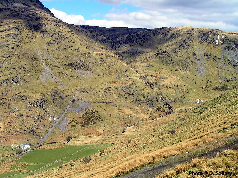
In this view looking across the upper reaches of Cwm Croesor can be seen: